ON THE RISE
45.5389° N, 111.1194° W
406-581-8689

45.5389° N, 111.1194° W
406-581-8689

Gallatin Valley Outfitters
Aaron Wert • Owner/ Outfitter #10484
Office 406-581-8689
2661 KidCurry Dr., Bozeman, MT 59178 • gvo@gallatinvalleyoutfitters.com
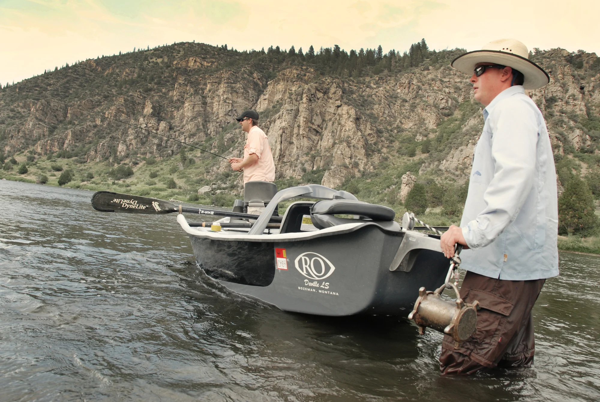
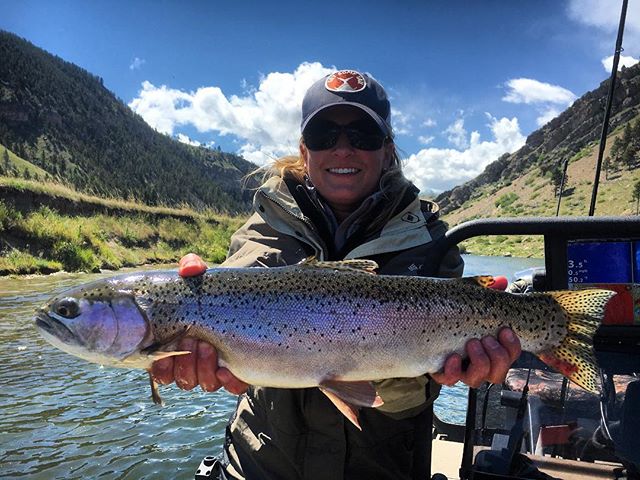
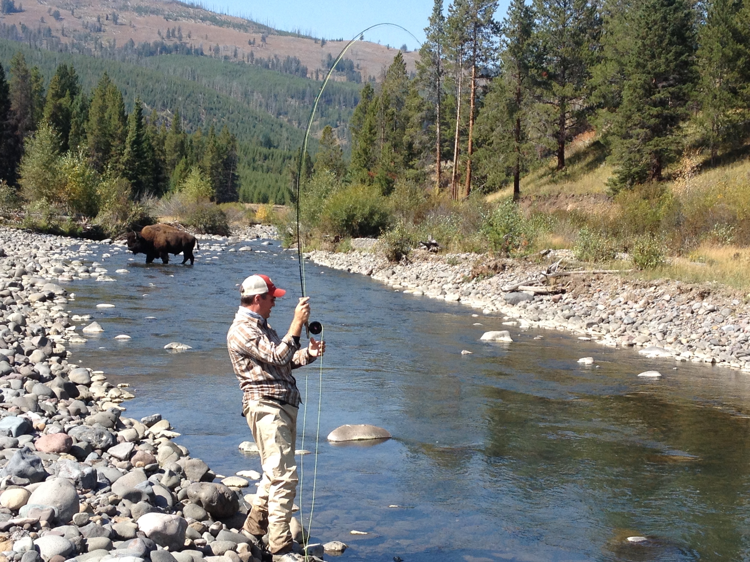
Aaron Wert, owner and outfitter for Gallatin Valley Outfitters, knows his water. Originally from Minnesota, land of 10,000 lakes. Aaron has called the water in southwest Montana home since 1996. Though if you ask his two yellow labs, Oly and Lena, they’ll tell you there will always be room for a little mid-western love in his heart. The true all around guide, Aaron has been mentioned in both Forbes and Western Horseman for his guiding abilities.
GVO is located in the heart of the beautiful Gallatin Valley, in Bozeman Montana, just 45 minutes from Big Sky. Their centralized location allows you more options than you could fit into a weeks worth of fishing and Aaron will guide you to the most productive waters available during your time in this great area. As a United States Coast Guard Captains license holder, GVO offers even more options than most outfitters.
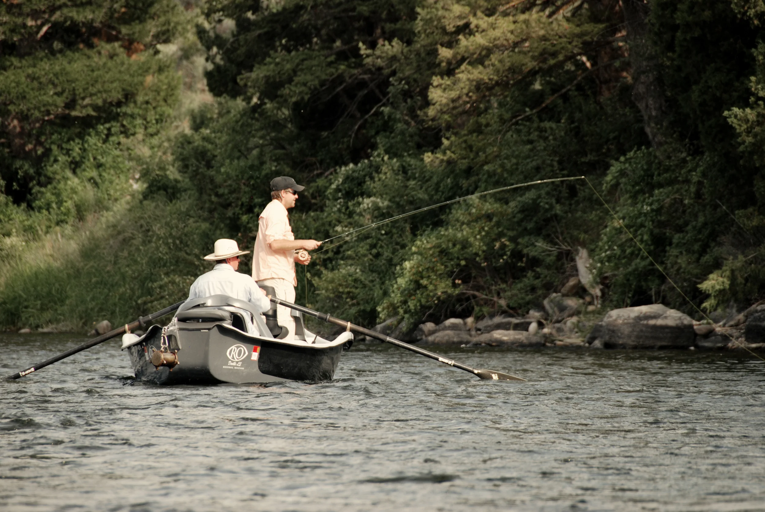
Whether you are new to the sport or a seasoned pro, GVO will be there to offer help or quietly row the boat while you take in the beauty of the day. And when you need a photo of that trophy brown, he'll happily take the picture to show your friends back home the proof of your success.
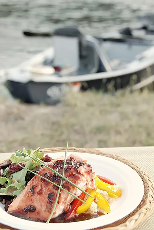
GVO is a complete experience.From a gourmet shore lunch* to an impromptu knot tying clinic riverside, GVO will go above and beyond your expectations to make your day a success.
*Did we mention that Aaron has years of experience cooking in some of the most exclusive kitchens in Big Sky? After five years with the Yellowstone Club, he spent the last 2 winters running the kitchen for The Club at Spanish Peaks' sleigh ride dinners.
Gallatin Valley Outfitters
Aaron Wert • Owner/ Outfitter #10484
Office 406-581-8689
2661 KidCurry Dr., Bozeman, MT 59178 • gvo@gallatinvalleyoutfitters.com
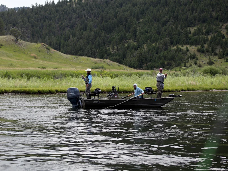
Our trips include:
Full day: guide, transportation, tippet, flies, lunch, non-alcoholic beverages
Half Day: guide, transportation, tippet, flies, non-alcoholic beverages *Seasonal
Flies and Tippet: At Gallatin Valley Outfitters, our time on the water is best spent getting you on fish. It’s not the time to be worried about having the right fly or running out of tippet. That’s why we included them in your rate. We don’t want to nickel and dime you. We just want you to catch fish.
Lunches: Lunches on the river can range anywhere from a simple sandwich to a gourmet shore-side lunch. At the time of your booking, we can discuss these options with you.
NOT included on our guided fishing trips are:
Rentals: Should you need waders or boots, just let us know. We have those items available for rent.
Personal items needed for the day
Additional Rod Fees
Gratuities
Rate information. (Click to download)
Contract for services. (Click to download)
Gallatin Valley Outfitters
Aaron Wert • Owner/ Outfitter #10484
Office 406-581-8689
2661 KidCurry Dr., Bozeman, MT 59178 • gvo@gallatinvalleyoutfitters.com
Pick your time of day:
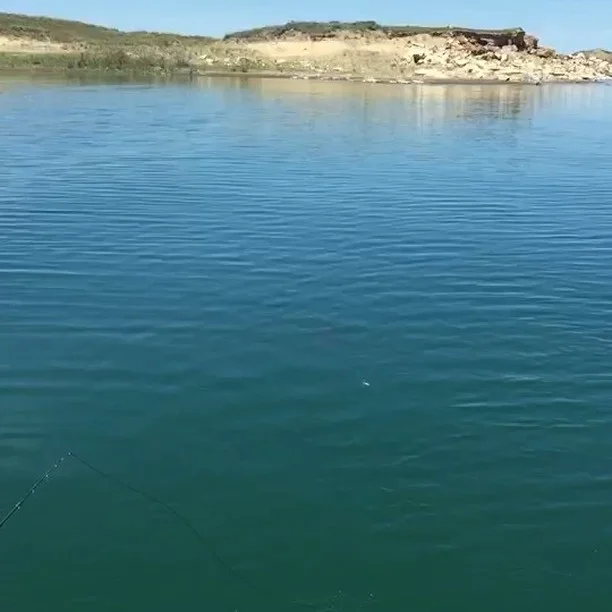
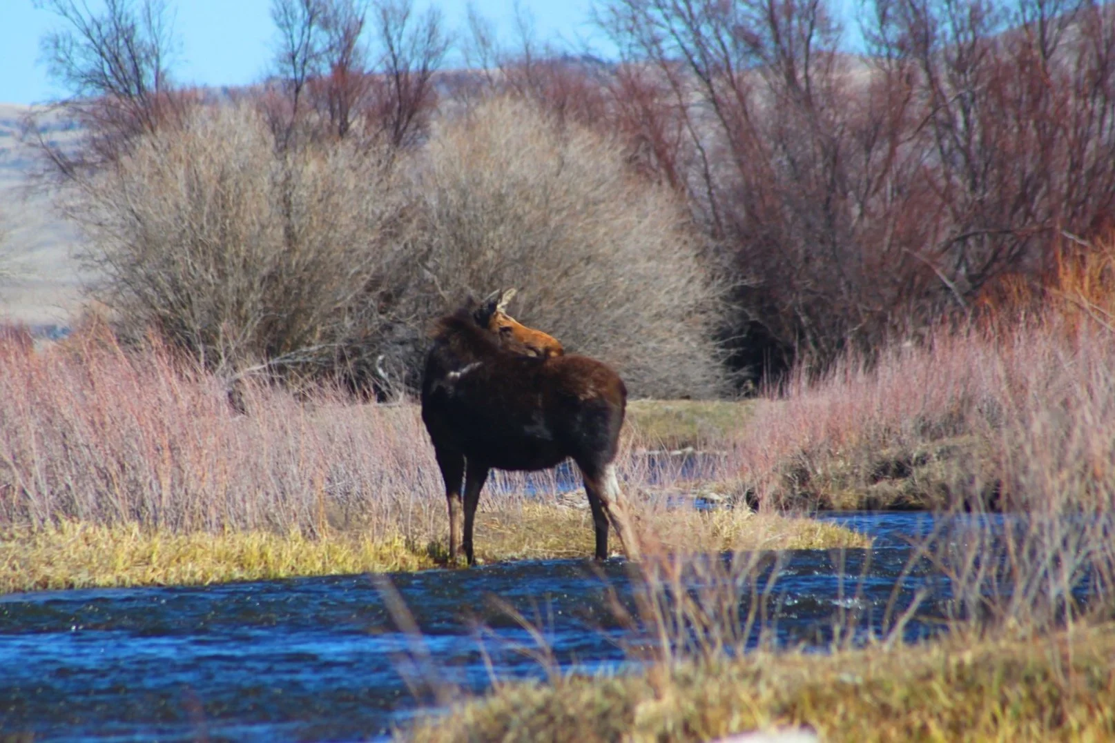
Morning Float: Morning floats are better for seeing animals and photos of the sunrise. Start times are based on season and are flexible to meet your schedule. The floats are 2-3 hours long on the river of your choice. The guide will consult with you on the ideal river to float based on the experience you are looking for.
Midday float: Midday floats are great for filling the gap in your day, admiring the mountains and experiencing the rivers unique character. Start times are based on season and are flexible to meet your schedule. The floats are 2-3 hours long on the river of your choice. The guide will consult with you on the ideal river to float based on the experience you are looking for.
Evening Float: Evening floats are idea for seeing animals and taking photos of the sunset. Start times are based on season and are flexible to meet your schedule. The floats are 2-3 hours long on the river of your choice. The guide will consult with you on the ideal river to float based on the experience you are looking for.
NOT included on our Scenic Floats are:
Personal items needed for the day (sunscreen, binoculars, etc.)
Food/Beverage (We will have water on the boat for you.)
Gratuities
Call for availability and pricing.
Contract for Services. (Click to download)
Gallatin Valley Outfitters
Aaron Wert • Owner/ Outfitter #10484
Office 406-581-8689
2661 KidCurry Dr., Bozeman, MT 59178 • gvo@gallatinvalleyoutfitters.com
Looking to juice up your fitbit steps? Join us for a day of walking the water and taking in nature. Our walk wade trips include the following:
Shuttles to and from the river
Shore Lunch with non-alcoholic beverages
Flies for the day
NOT included on our guided fishing trips are:
Rentals: Should you need waders or boots, just let us know. We have those items available for rent.
Personal items needed for the day
Rental equipment (if needed)
Additional Rod Fees
Gratuities
Rate information. (Click to download)
Contract for services. (Click to download)
Gallatin Valley Outfitters
Aaron Wert • Owner/ Outfitter #10484
Office 406-581-8689
2661 KidCurry Dr., Bozeman, MT 59178 • gvo@gallatinvalleyoutfitters.com

Minnesota in Montana, Aaron knows a thing or two about fishing hard water. Ice fishing is a great way to have some winter fun outside if your legs cant handle skiing for 5 days straight. Mix in a day with us and relax with a great lunch while we catch your dinner. If you are a serious ice angler, call us and ask about our Fort Peck trips. Trips for 1 or 2 anglers and include the following:
Shuttles to and from the lake
Shore Lunch with non-alcoholic beverages
Bait for the day
NOT included on our guided fishing trips are:
Personal items needed for the day
Additional Rod Fees
Gratuities
Rate information. (Click to download)
Contract for services. (Click to download)
Gallatin Valley Outfitters
Aaron Wert • Owner/ Outfitter #10484
Office 406-581-8689
2661 KidCurry Dr., Bozeman, MT 59178 • gvo@gallatinvalleyoutfitters.com
If you are looking for a one of a kind fishing experience, join us for one of our jet boat trips and access water you haven't dreamed of fishing. Our jet boat trips include the following for 1 or 2 anglers:
Shuttles to and from the lake
Shore Lunch with non-alcoholic beverages
Bait for the day
NOT included on our guided fishing trips are:
Rentals: Should you need waders or boots, just let us know. We have those items available for rent.
Personal items needed for the day
Additional Rod Fees
Gratuities
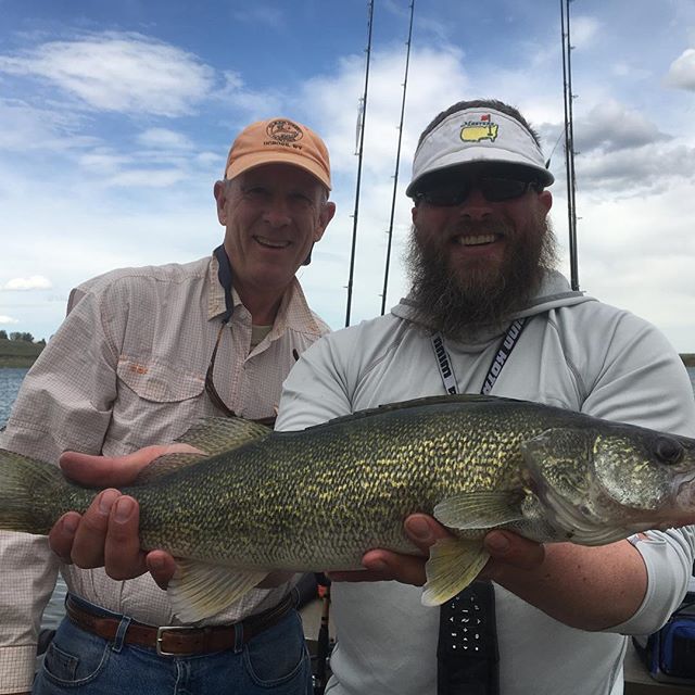
No and yes. We try to practice catch and release. Depending on the regulations, it is within your rights to keep the fish. We are conservationists at heart, not to mention that these fish are our livelihood. If we are in the lakes or on the Missouri we don't mind as much. If you are on a walleye trip... it's encouraged!
This is a very common question. The type of trip and experience you are searching for may weight your decision. Spring runoff is typically over by late June and the prime summer fishing continues through July and August. Expect to run into more tourists and other fisherman at this time as well. If you are searching for more solitude then the spring and autumn months may be for you, the fishing can be spectacular but so can the weather so plan your dress accordingly. There is no bad time to fish Montana.
Don’t worry that’s why they all have warranties. You would be responsible for a $80 fee that covers the rod, shipping and handling.
“Clear to mostly cloudy with a chance of precipitation, winds gusting variably.” With that said, it is not uncommon to see afternoon showers in Montana. Dress in layers.
Feel free to bring your own fav’s or home ties, but your guide will also have a wide range of local flies for you.
Of course, your guide will also have rods available to use for no extra charge.
Lunch options are as varied as fly options. Before your trip we’ll make lunch arrangements with you. We can do a fast lunch like a sandwich or wrap so you can get back on the water and keep fishing. Or also offer a causal shore lunch where we can grill you up something nice. Make sure to tell us about any food allergies!
We encourage you to find another person for a second boat. Only two people can fish at one time so the third is sitting, not having fun, watching everyone else. $125 extra fee.
No! You don’t need it anyway, you’re on vacation!
GVO would prefer if you celebrated at the end of the trip. Beer tastes better at the end of the trip anyway.
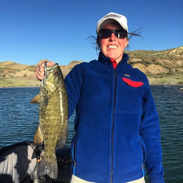
Sure. GVO will gladly teach you how to fly fish, but we are happy to take you out fishing however you are comfortable. GVO also offers spin fishing and trolling trips for trout, walleye, pike and bass. Just ask!
You can cancel 7 days in advance of your trip and get your deposit back. Inside of 7 days the deposit goes to the guide. The guide season in Montana is fairly short and our guides make themselves available each and every day. They try and pack a lot of work into a fairly short period of time so they are often booked for multiple days weeks or months in advance. If you didn't go chances are they would have gone out with someone else.
“If you don’t like the weather just wait 15 minutes.” If it looks like it might rain- it probably will, but not for long. The weather in Montana is usually short lived.
Gallatin Valley Outfitters accepts cash, checks. No Credit Cards.
A deposit of $100 for a half-day and $200 on a full day per guide is needed to hold the reservation. Full Refunds will be given to if canceled 7 days or more in advance of the trip.
Reservation will only be considered complete after your deposit is received and this disclaimer is signed and received by Gallatin Valley Outfitters.
We don't.
Although it is not required, guides do work for tips, there are a lot of behind the scene costs the guide racks up. 20% or $100 is about standard. If you feel you had a great day don't be afraid to let your guide know. Ask yourself honestly if the guide worked hard to keep you fishing. How much gear did you go through? Did you have fun?